Top 10 Sunshine Coast Hinterland Walks
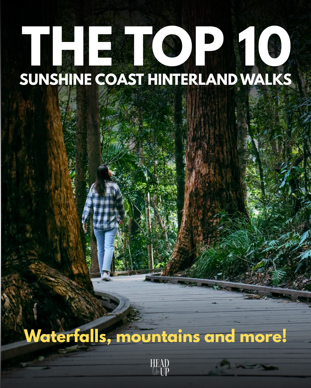
Some of Australia’s best walks are right here on the Sunshine Coast Hinterland, and we are spoiled for choice with a long list of walking trails, both short and long, for all skill levels, that are ready to be discovered on your next visit to the region. Our vibrant nature is evident at every step, with charming birdcalls, wildlife, and spectacular views of deep valleys, rivers, waterfalls, and grand mountains. From hearing the roaring waterfall as you cascade down the stone steps at Kondalilla Falls, hopping over the stepping stones while crossing the creek at the Narrows & Baroon Lookout Track or taking in the grand view of the Glass House Mountains above Beerburrum Lookout, we have gathered the top 10 walks in the Sunshine Coast Hinterland for your next stay.
THE MALENY TRAIL
MALENY | 6.7KM RETURN | 2HRS
MAPS
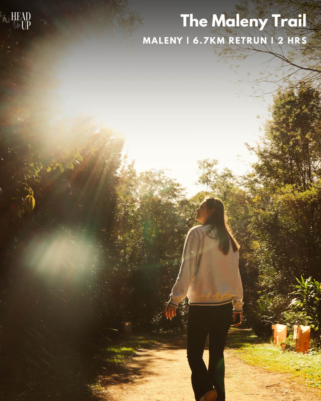
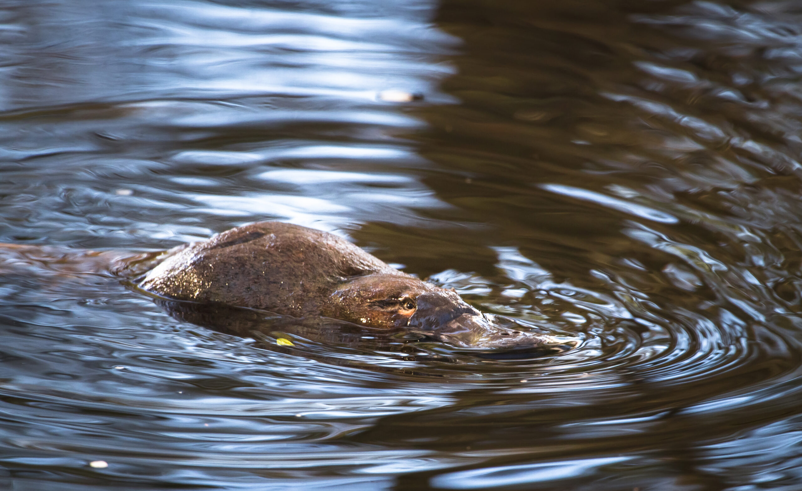
Platypuses are some of Australia’s most treasured national animals, often elusive mammals that appear to quite like the waters at Obi Obi Creek. Fitted with a purpose-built platypus viewing deck and winding paths through rich vegetation and rainforest trees, the Maleny Trail may be your best chance at spotting a platypus on the Sunshine Coast Hinterland. Early mornings or late afternoons are the best times to spot one, making it an essential must-do if staying in Maleny. This trail is well-loved by locals and visitors alike, and over 54,000 trees have been planted along it through community efforts and support from Maleny IGA.
This 6.7km return walk begins at the Maleny Showgrounds, where you can park at the back left of the sports field, near the tennis courts, for the closest entrance to Obi Obi Creek via the footbridge. Follow the banks of the river along the pathway for 1.5km until you come to an opening in the Maleny Township. Continue right along the path, past the library and across the road to the boardwalk at the back of the Riverside Centre (A collection of small shops near the Maleny roundabout). Look for the river if you get lost!
Follow the well-signposted trail along the creek with the platypus viewing platform roughly 2.5 km from the entrance of the Riverside Centre. Continue along the path past the local horse paddocks, and the trail will become grassy; however, do not let this deter you from exploring further, as some of the best parts of the walk are up ahead. Walk past the back of the Maleny Golf Course and enter the dense forest, one of the most beautiful sections of this walk. You’ll eventually come to a fork with a pathway leading to a picnic area and a river access point, which is well worth checking out.
Continue left to walk up a slight incline and back down Parklands Drive, enjoying a grand view of Maleny.
FIG TREE WALK
CONONDALE | 2KM RETURN | 30 MINS
MAPS
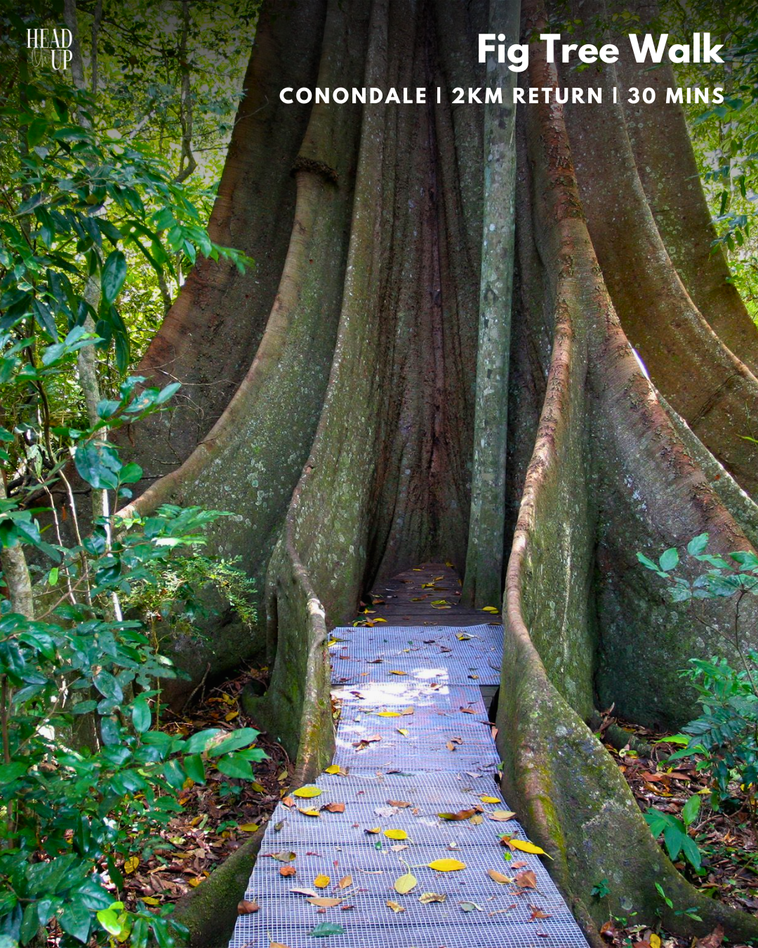
Making your way to Conondale or Kenilworth? Make sure to stop at the short and family-friendly Fig Tree Walk for giant specimens of the Moreton Bay Fig and an upgraded wooden boardwalk that takes you on a discovery of the local fauna and flora. Park across from the Little Yabba Rest Area in the small carpark and walk across the bridge pathway towards the walk entrance.
On a dedicated platform, there is one large fig in particular that’s gaining fame for its photo opportunities, which you’ll spot early in your walk. Head down to Little Yabba Creek from the car park after your walk to get your feet wet or enjoy a picnic before continuing to Conondale or Kenilworth.
MARY CAIRNCROSS RESERVE
MALENY | 1.2 – 2KM RETURN | 45 MINS
MAPS
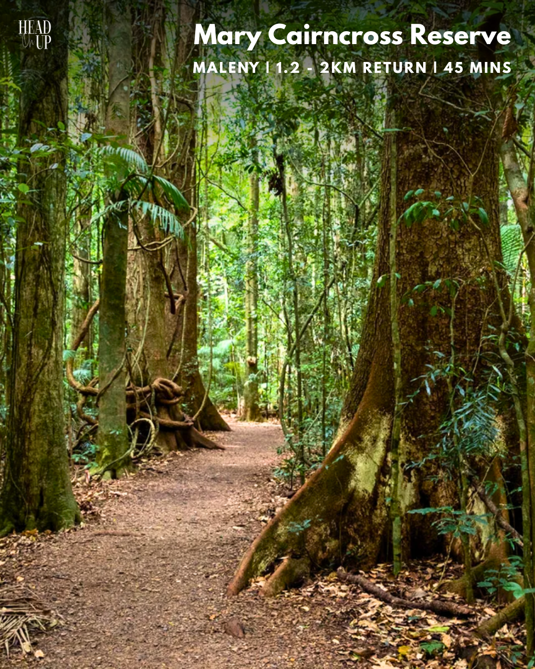
If you’re only visiting Maleny for a short stay, we recommend making time for a morning at the Mary Cairncross Reserve and the Rainforest Discovery Centre. With extensive parklands, wonderful rainforest walks, a delicious cafe, an immersive discovery centre and a glorious view of the Glass House Mountains, this location, just 10 minutes’ drive from the Maleny township, is well worth your while. Families can spend the whole day here, utilising the free BBQs and sheltered picnic areas that are near the toilet, playground and carpark. The main walk is one of the best remaining subtropical rainforests in Australia; you can imagine this being a place where dinosaurs once roamed, with its ancient palms and narrow waterways. Glimpse the rich variety of birds, the rainforest Wallabies (Pademelons) and perhaps the endangered Richmond Birdwing Butterfly.
Further popularised by visiting local touring companies and school excursions, be sure to visit the reserve at off-peak times through the week, or be prepared to search for a long time for a park on a public holiday or weekend. Decide to get a hot chocolate or a coffee before walking from the Mountain View Cafe, or save it for a well-deserved lunch after your walk through the nature reserve. The newly renovated hub has an upstairs viewing deck and a discovery centre located beside the cafe.
NARROWS & BAROON LOOKOUT
MONTVILLE | 5.5KM RETURN | 2 HRS
MAPS
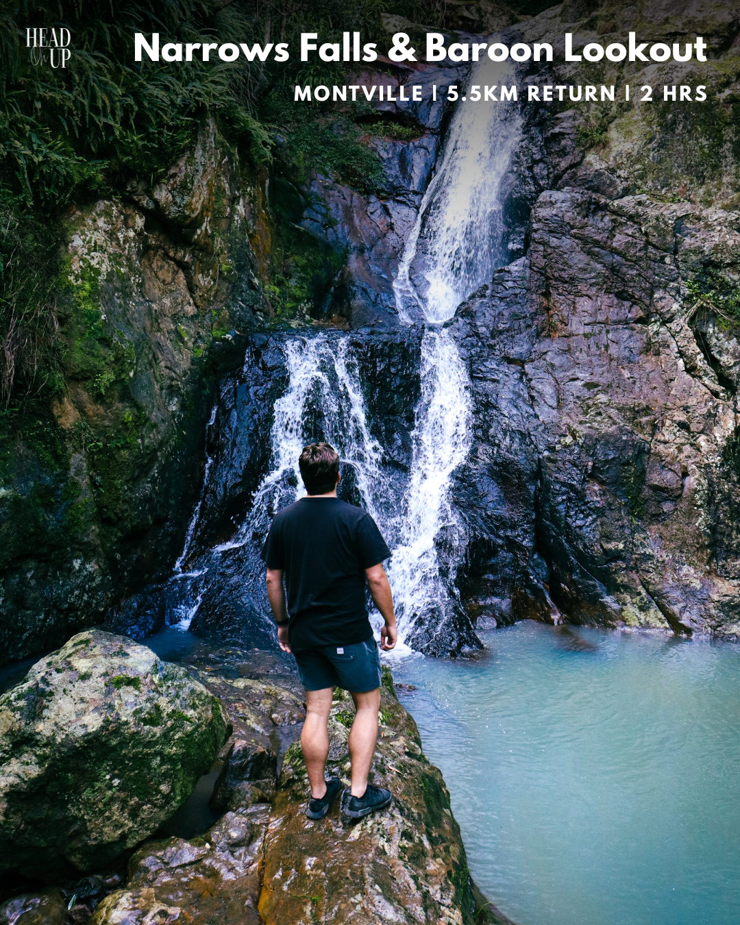
If you’re surprised you haven’t seen Montville on this list yet, let’s get the ball rolling with this local favourite, located just minutes from the centre of town. The Narrows & Baroon Lookout Walking Track car park is on the right, just before you enter Secrets On The Lake and the North Entry to Baroon Pocket Dam, which makes for a cracking sunset location over the water. Wander over creek crossings and through the lush rainforest trail and prepare for stunning views of the Narrows Gorge and Obi Obi River in this magnificent section of Kondalilla National Park.
Parking is very accessible; however, there are no toilets or facilities for filling water bottles. Water, bug spray and appropriate footwear are recommended on this 5.5km return walk.
Start the track through the entrance gate and cross the first river crossing at a light elevation for about 500m before arriving at a fork. Turn right to head towards Narrows and Baroon Lookout, and turn left to descend the stone steps to the Obi Obi River. The river is well worth a visit, but it adds another 1 km round trip and a steep elevation gain to your journey.
Continue right for 1.5km, past a hollowed-out tree seat and abundant wildlife, and you’ll come across another path towards Narrows Lookout. Follow for 200m for a large waterfall and a lookout over the gorge. Continue on the original path for another 1.5 km to reach the top of Baroon Lookout, observing the dam from afar.
MT.NGUNGUN TRAIL
GLASSHOUSE | 6KM RETURN | 2 HRS
MAPS
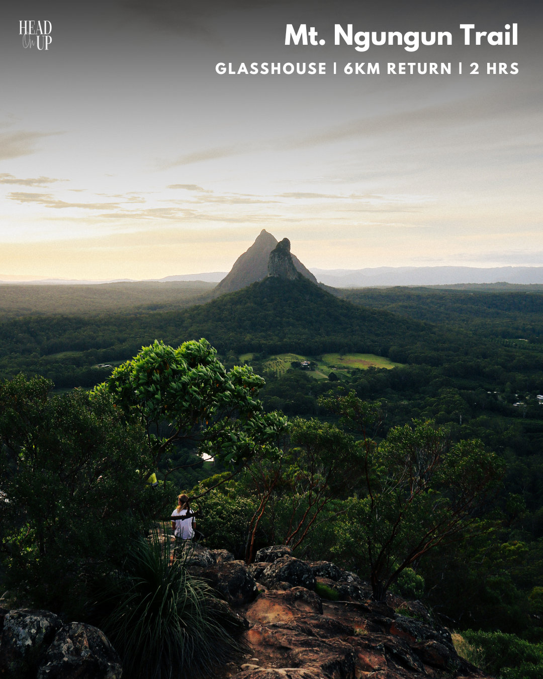
Mt.Ngungun, with a peak of 253 metres, is the sixth-highest mountain in the Glasshouse Mountains. Although it is considered one of the more straightforward mountain tracks in the area, its steep steps can be rather challenging. However, it is the perfect place to start experiencing incredible summit views before moving on to more experienced climbs in the region. At the end of this 1.4km track through forests and ferns, the pinnacle provides full 360-degree views of Mt.Coonowrin, Mt. Beerwah, Mt.Tibrogragan and more!
This is a popular walking track, especially around sunrise and sunset, so be prepared to pass other people on your journey. The car park is relatively large, with extra parking across the street, but it fills up quickly around these popular times. It’s only a
10-minute drive from Beerwah’s CBD, so it’s no wonder it’s a local hotspot for fitness enthusiasts.
The walk begins in the forest with winding pathways and regular stone steps, and the sounds of the local wildlife fill the air. After some reasonably level ground, you’ll come to the To Mt. Ngungun Summit sign. This is your heads up that the steps are about to get steeper. Conquer the flight of steep stairs and continue onwards before discovering a large natural cave and a great viewing point of Mt.Tibrogargan through the trees. Your elevation rises as you climb the steps, continuing along the fern-filled track. You’re over halfway to the summit now. The track flattens more near the top, and the hardest slug is through the middle stage. You’ll start to feel the breezes through the tree clearings and see the Sunshine Coast Coastline. You are just minutes from the top. With sheer cliff faces and uneven ground, taking your time as you approach the summit is advised.
MAPLETON FALLS & WOMPOO CIRCUIT
MAPLETON | 1.3KM RETURN | 45 MINS
MAPS
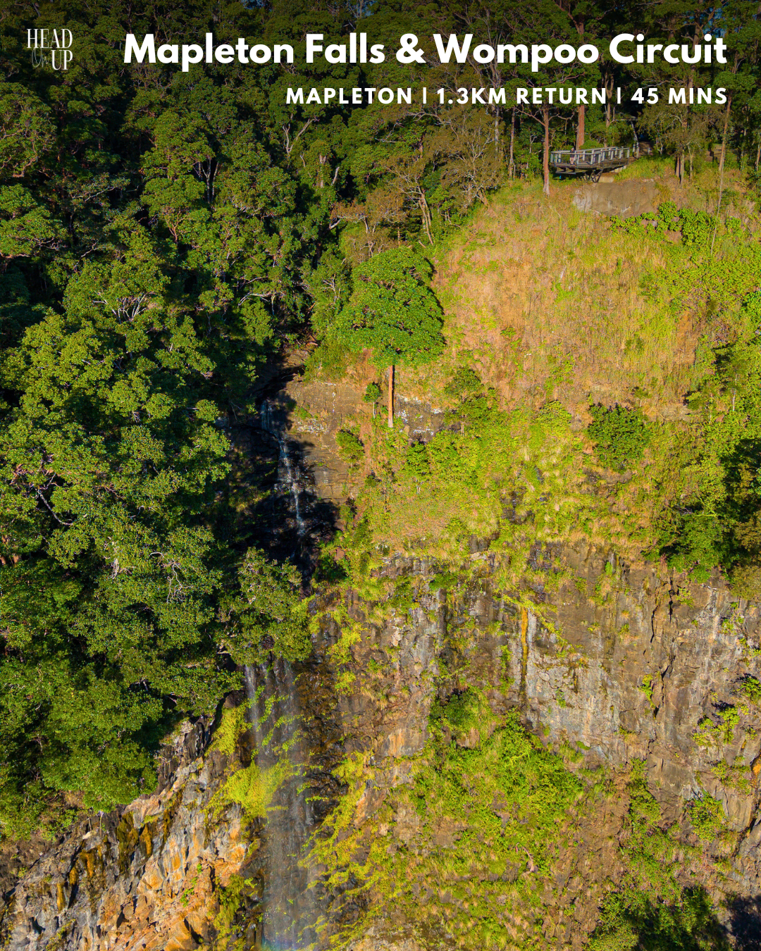
If you’re looking for a quick and easy spot to see some waterfall action, take advantage of the almost drive-thru experience at Mapleton Falls National Park.
Arrive at the car park, and only a few short steps away from your car, you’ll find the overhanging boardwalk that lets you step out over the sheer 200m drop, offering a rare opportunity to see the waterfall from both the top and bottom. Do not stray off the enclosed path and take extreme caution around the cliff’s edges.
This area also includes a picnic area and a 1.3km track called the Wompoo Circuit, named after the frequent calls of the woompoo fruit dove heard on your rainforest walk. Towards the end of the circuit, you will also find a second lookout location over the nearby rainforest.
KUREELPA FALLS TRAIL
KUREELPA | 6KM RETURN | 2 HRS
MAPS
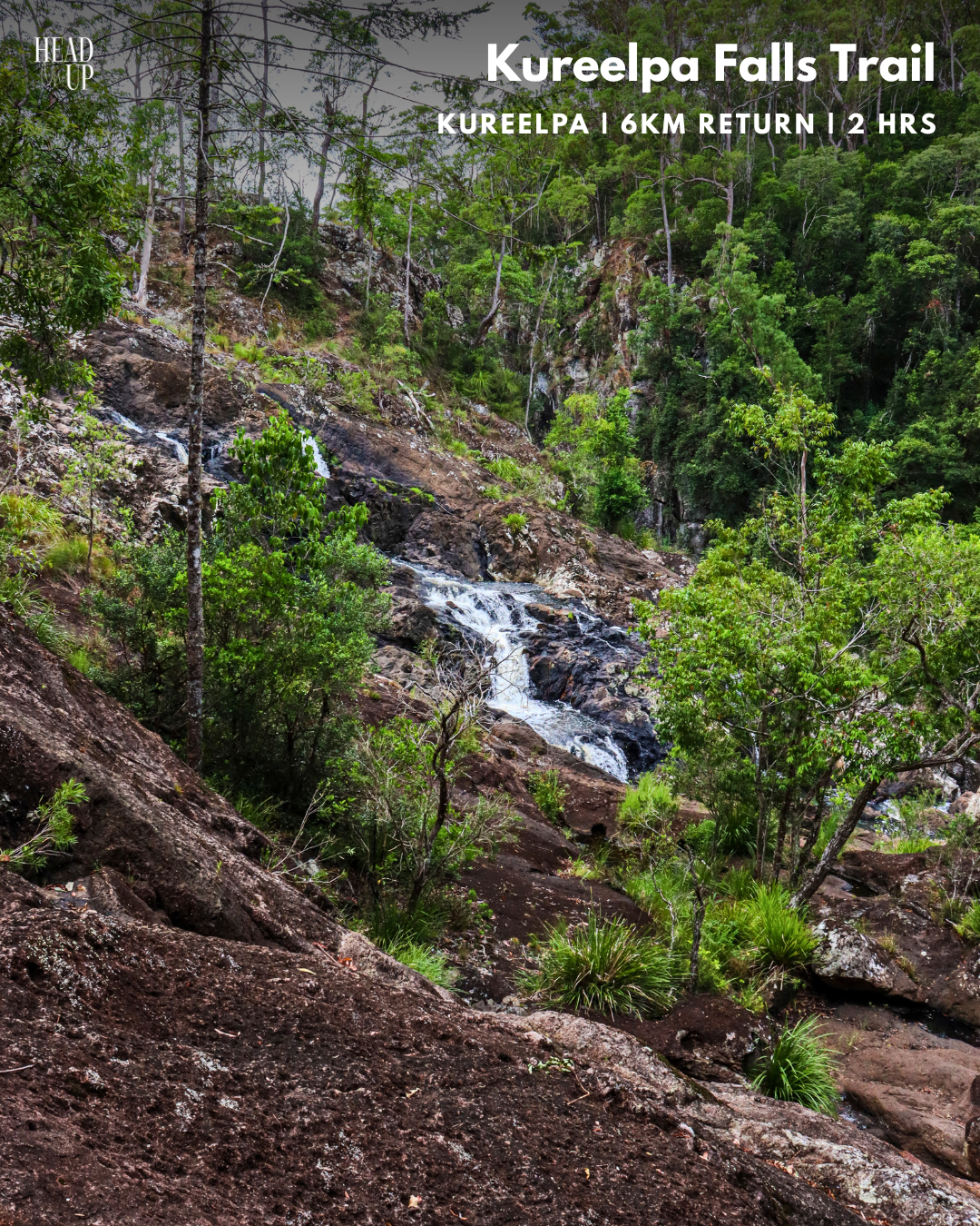
Are you seeking a hidden waterfall, do you enjoy rock-hopping, and do you love bushland walking tracks? Kureelpa Falls is one of the more unknown waterfall locations in the hinterland, but it makes an excellent spot for a picnic and an adventure! Although this is a shorter walk than some, it is still advised to bring water and sun protection. Durable and grippy footwear is also recommended.
Kureelpa Falls is only 10 minutes from Nambour, and a full return walk from the carpark to the falls is approximately an hour. To get there, follow Mapleton Road from either Nambour or Mapleton and turn into Kureelpa Falls Road, directly opposite Dulong Lookout. Following the winding road with glorious views, continue till you reach the end of the road, and here you’ll find a small carpark and entry gate.
Follow the grassy track for 600m and veer left at the fork, following the walking signs. The alternate “No Horse’ route to your right continues for roughly 1km before you lose sight of it on a very steep mountainous descent. Staying left, continue for 1.5km through the bush track before arriving at a running creek. Follow the small, winding path to the creek’s right for 400m until you arrive at a clearing that shows off Kureelpa Falls. If climbing rocks isn’t your forte, it may be best to snap a picture here and head on back, but for the young at heart, carefully climb down towards the falls.
Kureepla Falls has so many interesting and beautiful places to discover. Follow the river atop the falls before it trickles down over multiple waterfalls and into rockpools, or stand beneath them and watch it all happen before your eyes!
MOUNT BEERBURRUM LOOKOUT
BEERBURRUM | 3.5KM RETURN | 1.5 HRS
MAPS
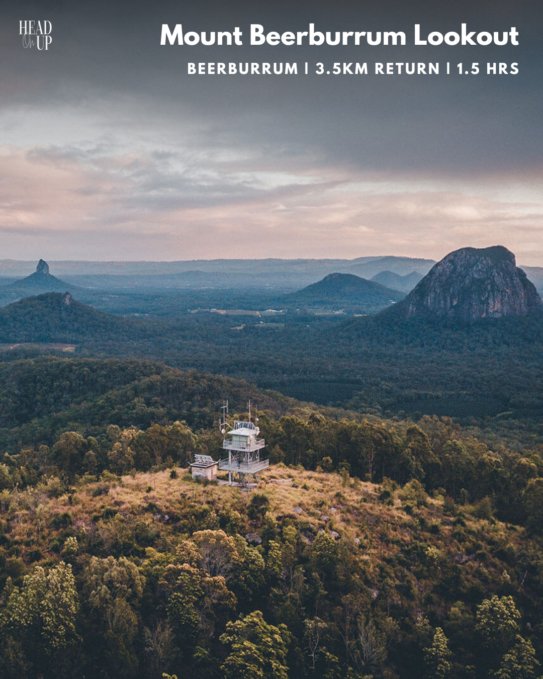
Ready for a knockout view of the Glasshouse Mountains? Bring your walking shoes and head towards Mount Beerburrum Lookout, which is across the road from
Cafe Phillies is located adjacent to the Beerburrum State School.
After its initial zigzag path, this climb has a rather steep elevation towards the Fire Tower at the summit; however, there are seats along the trail to take a break. The entire walk will take roughly 90 minutes and cover 3.5km. Once you reach the top, the 360-degree views from the Fire Tower are amazing. With the entire Glasshouse Mountains before you, it’s worth spending a few minutes here to soak it all in. On a clear day, you can even see the Brisbane CBD!
BAXTERS FALLS
FLAXTON | 6KM RETURN | 3 HRS
MAPS

If a philosophy reads “the longer the walk, the greater the waterfall, it would apply to Baxter Falls, nestled away in Flaxton, 10 minutes from Montville. Walking down nearly 300m of elevation over 3.3km, you will be rewarded with the suspension bridge across Baxter Creek with the falls to your right.
Baxter Falls is one of the less-visited falls because it’s farther, but it makes for a perfectly private spot for lunch or a swim if you’re up for it! Parking is only minutes away from The Barn On Flaxton and is located on a quiet residential street.
Be sure to bring snacks and plenty of water, as the significant descent makes the return to the car a long journey, especially on a hot day for casual walkers. Watch for nestling echidnas and lyrebirds at the creek bottom.
KONDALILLA FALLS
MONTVILLE | 5KM RETURN | 2 HRS
MAPS
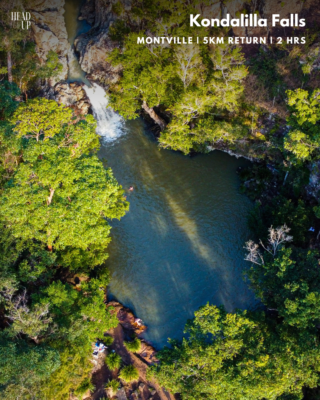
Kondalila Falls, meaning ‘Rushing Water’ to the local Kabi-Kabi tribe, has held significant cultural connections for thousands of years. With beautiful waterfalls along the way, it’s clear why this location attained its name.
Featuring the Fairy Pools (500m), Main Swimming Hole (2km) and Full Track (2-3hrs), Kondalilla is a frequent feature in our Head On Up volumes due to its stunning natural environment. If there’s only room for one nature stop on your hinterland itinerary, this would be our recommendation.
This walk features three large waterfalls: the Fairy Pools, the Main Swimming Hole (Kondalilla Falls), and the grand Rock Pools, which await you at the bottom of the Full Circuit. Walking through Kondalilla Falls provides surprise after surprise and is truly unmissable. If you do not want to complete the whole walking track but would like an alternative viewpoint of Kondalilla Falls, stay at the steel-fenced staircase, and you’ll reach a lookout with a seat.
Have you explored our Top 10 Sunshine Coast Hinterland Walks?
Find more to do on the Sunshine Coast Hinterland here.
Read More Guides
- Top 10 Sunshine Coast Hinterland WalksTop 10 Sunshine Coast Hinterland Walks Some of Australia’s best walks are right here on the Sunshine Coast Hinterland, and… Read more: Top 10 Sunshine Coast Hinterland Walks
- Sunshine Coast Hinterland 2026 EventsThe Sunshine Coast Hinterland 2026 Events Guide is here! Our region is home to many new and annual festivals, fairs… Read more: Sunshine Coast Hinterland 2026 Events
- The Best Waterfalls In The Sunshine Coast HinterlandThe Best Waterfalls – Sunshine Coast Travel Guide The Sunshine Coast Hinterland is renowned for its spectacular waterfalls and rainforest… Read more: The Best Waterfalls In The Sunshine Coast Hinterland
- Top 5 Wellness Retreats Sunshine Coast HinterlandIn this guide you’ll discover the Top 5 Wellness Retreats – Sunshine Coast Hinterland. If you had to pick a… Read more: Top 5 Wellness Retreats Sunshine Coast Hinterland
- The Best Places To Stargaze In The Sunshine Coast HinterlandWant to discover the best places to stargaze in the Sunshine Coast Hinterland? The Sunshine Coast International Dark Sky Reserve… Read more: The Best Places To Stargaze In The Sunshine Coast Hinterland